Today has been a long day. Quite literally—it has already lasted 30 hours, and it’s only 21:00 Pacific time. I spent a large part of it flying to San Francisco, and this post is about my impressions from that flight.
My aerial journey started with spectacular views of the French alps, the Jura, and the lakes of Leman, Joux, Neuchâtel, Bienne, Morat. Then France and England. Later sporadic views of Greenland, Canada, Montana, and Oregon. And all these views were dominated by one thing: humans. We have filled the earth…
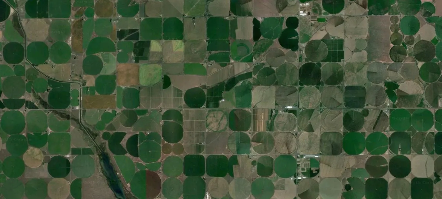
To me, it’s a frightening thought. But it seems inescapable. Whenever there was a patch of flat land, a road or field was not far away. I could see from above how we’re using up the surface. And, apparently, the water under the surface. It reminded me of how I started a blog eight years ago:
Ich habe nicht gewusst, dass es so viele verschiedene Grün und Braun gibt. Jetzt, da ich über Indien fliege, ist es unmöglich, sie alle zu benennen. Ich sehe Felder, selten Wald, unzählige verästelte Flüsse, Flüsschen und Bäche mit kleinen Seen dazwischen. Und doch während dem ganzen Überflug keine Stelle, die nicht von geraden Linien durchzogen wäre. Jeden Augenblick sieht man ein neues Dorf als hell-dunkel gescheckte Fläche. Unbegreiflich, wie viele Menschen da unten leben. Und mit jedem Atemzug bin ich zwei Kilometer weiter, überfliege ich die Leben von tausenden von Menschen mit ihrer eigenen Geschichte…
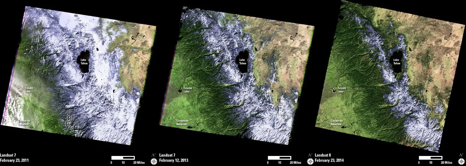
Today’s flight felt even more extreme. The world changes, with frightening speed. The image below is a current example from California. California declared a drought state of emergency in January, mainly because the snow reserves in the Sierra mountains do not hold enough water for the coming summer. The pictures below were taken by the LandSat satellite in 2011, 2013, and 2014. They show just how massive the current drought is.
I do not yet know what to make of these impressions. This post feels somber, yet I am first of all glad to be here. I’m full of energy, ready to use my talents to build something great during the three months at Google.
Ready to contribute to human progress… right?